Ambitious attempt to map Italy’s coastline starts with seagrass
The Italian Marine Ecosystem Restoration project operating in ‘a data-driven and proactive way’.
They may be small and often overlooked, but seagrass plays a role in keeping our oceans healthy. Seagrass meadows create vital habitats for marine life, capture and store carbon, and help stabilise coastlines. Yet, seagrass meadows are disappearing at an alarming rate due to coastal development, pollution, and climate change. Italy hopes to reverse that trend with the ambitious Marine Ecosystem Restoration (MER) project.
“[The MER Project] is the first of its kind by any country to plan nature restoration measures at country scale in a data-driven and proactive way,” says Dr Pooja Mahapatra, Market Solutions Lead – Climate & Nature at Fugro.
In partnership with Compagnia Generale Ripreseaeree (CGR) and subcontractors PlanBlue and EOMAP (which recently became part of Fugro), Fugro will deliver the mapping component of the MER Project.
“This mapping is just the first step of [MER]. The data will help us understand the growth or degradation of seagrass meadows, guiding decisions on which areas to prioritise for conservation and restoration. The ultimate goal is to reverse the decline in seagrass in Italy,” says Dr Mahapatra.
To capture all the data needed to guide conservation and restoration measures, the mapping component will use “a combination of several different cutting-edge technologies, at multiple scales all the way from space to the seabed”. Those technologies include airborne lidar bathymetry (ALB), multibeam echosounders, multispectral satellite imagery, and airborne hyperspectral imagery.
“[ALB] is like having a high-tech eye in the sky that can see underwater. It uses laser pulses to measure the depth of water bodies. It's perfect for mapping shallow waters, [whereas multibeam echosounders provide] detailed images of underwater features, making it ideal for mapping deep and wide areas,” explains Dr Mahapatra.
Meanwhile, the multispectral satellite imagery from EOMAP “provides valuable data for monitoring environmental changes” and the airborne hyperspectral imagery by CGR “offers comprehensive spectral data across various wavelengths, allowing for precise evaluation of vegetation health, including seagrass detection and condition”.
Coastal erosion and flooding dangers addressed
With a scheduled completion date of June 2026, mapping the entire Italian coastline is undoubtedly a complex undertaking. “Coordinating the deployment of airborne lidar, multibeam echo sounders, and autonomous underwater vehicles (AUVs) requires meticulous planning and execution. It's like orchestrating a symphony where every instrument needs to play its part perfectly,” states Dr Mahapatra.
Other challenges include seasonal factors. “During Italy's busy summer tourist season, it's preferable to avoid near-shore AUV operations to ensure the safety and enjoyment of swimmers,” Dr Mahapatra notes.
When the mapping is finished, there will be what Dr Mahapatra describes as “a treasure trove of data available”. While each dataset will be useful in its own right, “The value of all this data lies in how they are combined, integrated, and analysed to derive insights,” continues Dr Mahapatra.
“Combining all these datasets will create a comprehensive map of coastal and marine habitats across Italian waters. This map will specifically highlight Posidonia oceanica (Neptune grass) and Cymodocea nodosa (little Neptune grass) seagrass meadows. All this information will be showcased on Fugro’s platform, providing a detailed and interactive map that helps making better and more targeted decisions.”
Although seagrass protection and restoration are very much in focus, the datasets gathered will have far-reaching benefits. “The project will also provide topographic and morpho-bathymetric data, which are crucial for addressing coastal erosion, sea-level rise, and flooding,” concludes Dr Mahapatra. “These issues are not only about climate and biodiversity but also national security, as much of Italy's critical infrastructure is near the coast.”
Tell us what you think about this article by joining the discussion on IMarEST Connect.
Discuss similar topics in the Coastal Science and Engineering Special Interest Group.
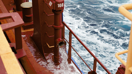
Image: Fugro Mercator in action; credit: Fugro.