Earth’s final frontier: the race to map the world’s ocean floor
Seabed 2030 is the ambitious project aiming to map the entire ocean floor. Amy McLellan finds out why it’s so important to maritime, and how collaboration between academia, governments, and industry will benefit us all.
Human beings are, mostly, creatures of the land. Our home planet may be 70 per cent ocean but we know more about the surfaces of the Moon and Mars than we do our own oceans. That, however, is changing, with an initiative to map the ocean floor now one-fifth complete.
“Mapping the Moon and Mars uses visual spectrum machines and technology but in the oceans we have to use sound and sonar and that’s a much slower process,” said Jamie McMichael-Phillips, project director of the Nippon Foundation-GEBCO Seabed 2030 Project. GEBCO stands for General Bathymetric Chart of the Oceans and it’s the only inter-governmental organisation with a mandate to map the entire ocean floor.
When the project launched in 2017, only six per cent of the ocean bottom had been surveyed to modern standards. Now that figure stands at 19 per cent, with some 14.5 million sq km of new bathymetric data added to the GEBCO grid in 2019 – about twice the size of Australia.
“We’re about to receive a terabyte of data covering another 1 million sq miles, which is another 0.2 to 0.3 per cent of the seabed. To put that in perspective, that’s about three and half times the size of the UK.” Jamie McMichael-Phillips, GEBCO
This effort is important because the oceans are fundamental to life on Earth as drivers of weather patterns and climate. “The more we understand them, the better we can predict and mitigate climate change and predict rising sea levels,” explained McMichael-Phillips. “It helps us understand rising temperatures and the impact of that on migratory species, sea grasses and other habitats and what that means for fishing grounds and conservation.”
Mapping brings the potential for better marine stewardship – you can’t protect what you don’t know exists – and acts as a catalyst for research into newly identified features such as underwater vents. These can host bio-organisms that may prove key to future pharmaceutical discoveries that could transform modern medicine.
Furthermore, a better understanding of previously unknown geological features and hazards, such as underwater volcanoes or plate movement, can inform forecasting and planning for tsunamis. Mapping the topography in areas near glaciers can unlock new understanding about the flow of water and temperature to help scientists predict ice melt and shelf collapse.

Jamie McMichael-Phillips, project director of Seabed 2030 (Credit: Seabed 2030)
Mapping the Arctic Ocean
Scientists from the Universities of Stockholm and New Hampshire, for example, recently co-ordinated a new depth map that increased the mapped area of the Arctic Ocean from 6.7 per cent to 19.6 per cent. This specific grid for the Arctic is important because the global grid is highly distorted near the geographic poles and the new data will help with predictive modelling of the fate of the Greenland Ice Sheet and rise in global sea level.
Call for global collaboration
Improved mapping has implications for all sorts of human activities, such as safer navigation or planning for offshore wind farms, undersea cables and pipelines. Of course, many private companies hold their own databases of the seabed, which may have been acquired for offshore exploration and are embargoed because they are deemed commercially sensitive.
McMichael-Phillips hopes these companies – and governments that hold data embargoed for reasons of national security – can be persuaded to donate at least lower-res versions of their data to the GEBCO grid.
Technology is also playing a role, with un-crewed, remotely-operated ships able to work 24/7 at lower risk, cost and carbon footprint than manned vessels. AI and machine learning technologies are also being deployed to crunch through the huge datasets being collected.
“We’re about to receive a terabyte of data covering another 1 million sq miles, which is another 0.2 to 0.3 per cent of the seabed,” said McMichael-Phillips. “To put that in perspective, that’s about three and half times the size of the UK.”
Even the COVID-19 pandemic hasn’t stopped the mapping effort, with technology allowing scientists with the Schmidt Ocean Institute to complete a first look at deep waters in the Coral Sea. A team of Australian scientists connected remotely to the research ship Falkor from their homes, collecting high-resolution seafloor maps and video footage of the deep ocean down to 1,600 metres.
Discovering new species
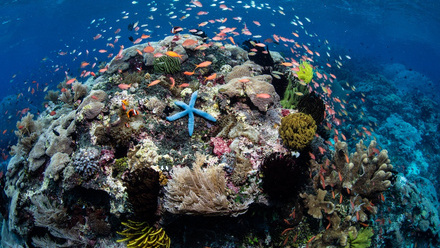
More than 35,500 sq km were mapped, illuminating a complex seafloor of 30 large coral atolls and banks, including submarine canyons, dune fields, submerged reefs, and landslides. Only the shallower parts of these reefs had been mapped previously, and until now no detailed mapping data existed of the deeper areas of the Coral Sea.
Using an underwater bot and high-res video camera, the scientists discovered the deepest living hard corals in Eastern Australian waters, sighted fish in regions where they had never been found before, and identified up to ten new marine species of fish, snails, and sponges.
2030 target: Next decade is crucial
However, even with the mapping gains made over the last 12 months, there is still another 81 per cent to capture to hit the 2030 target. That’s a surveying effort about twice the size of Mars in the next ten years.
“It’s a tall order,” admitted McMichael-Phillips. “But we made a lot of progress in the last year and we will be on track for 2030 if academia, governments and industry collaborate with us.”
Indeed, the Seabed 2030 project is extending this offer of collaboration to all mariners, from fishing trawlers to yachts voyaging in remote waters.
“You can fit a datalogger for a few hundred dollars – no bigger than a desktop stapler – and it’s just plug-and-play into the navigation system to log time, place and depth,” said McMichael Phillips. “This crowdsourcing bathymetry will be important to help us fill in the gaps in the GEBCO grid.”
Get involved: GEBCO is actively looking for people to take part in the project.
Read more: The GEBCO website has useful videos and resources, including its recent Seabed 2030: Mapping the World - Piece by Piece.

Amy McLellan is a freelance journalist and author and former editor of Energy Day.

