A brief report on my attendance at WWNWS in Monaco September 2023
Neil Salter, Co-Chair of the IMarEST MASS SIG shares an update on his attendance at the World Wide Navigation Warning System meeting in Monaco.
As well as my day job as Miscellaneous Publications Manager for the UK Hydrographic Office, like many people, I also have additional roles. One of these additional roles is Chair of the IMO NAVTEX Coordination Panel. As such, I attend the IMO Sub-Committee on Navigation, Communication and Search and Rescue (NCSR) and the IHO WWNWS meeting held annually, WWNWS being the World Wide Navigation Warning System.
NAVTEX is a service that provides navigational warnings which need to be promulgated or distributed swiftly so that people at sea can react to them accordingly. Ordinarily, it can take six weeks or more before routine chart or ENC (Electronic Navigational Chart) updates can be processed and delivered. Some of the content provided by NAVTEX will have been and gone within this timeframe.
NAVTEX has been around for about 40 years and is delivered in a way similar to old-fashioned telex, i.e., narrow band direct printing, and uses two main MF frequencies. In order to prevent interference or signal obliteration, NAVTEX stations are allocated a specific identification character and timeslot within a rolling twenty-four-hour schedule. It is the job of the NAVTEX Coordination Panel to assign characters and timeslots, then monitor the running of the system to ensure that everything runs as it should, that stations do not overrun their allocated slots and that the content of the navigational warning message meets the criteria of what should be broadcast.
There was a major change in the way ships are navigated some years back when the concept of ENCs was introduced. Previously, navigators used paper charts on a chart table. Typically, the chart table was surrounded by useful information such as NAVTEX printouts, weather report fax printouts and so on. With the change to ENCs, this evolved into an ECDIS (Electronic Chart Display and Information System) surrounded by much the same useful information such as previously.
Paper charts and then ENCs had to be produced in a way so that there was a common standard of appearance, a consistency of symbology, so that any user, no matter what their nationality or primary language, could ‘read’ and understand the information portrayed in front of them. This common standard is set by the International Hydrographic Office (IHO) based in Monaco.
Early on, the UN specialised agency, the International Maritime Organization, IMO, (formerly the Intergovernmental Maritime Consultative Organization, IMCO) realised that navigational warnings were fundamentally important and should be handled by an agency that could tie these warnings to an exact location so IMO passed the requirement for navigational warning promulgation to the IHO.
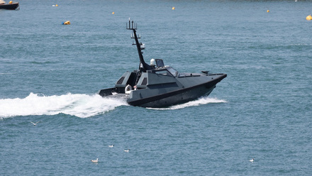
Currently, the specification or standard used when compiling ENCs is IHO Standard 57, or S-57 for short. The IHO will shortly be moving onto a more advanced standard soon, S-100. This development presented an opportunity in relation to MASS. Autonomous shipping needs awareness of navigational warnings and safety information just as much as conventional shipping does. In 2021, the IHO set up a MASS Project Team. This Project Team had a two-year mandate and was tasked with assessing the current maturity of MASS globally and to prepare a gap-analysis to identify what essential hydrographic information and features was not currently accessible by MASS.
This entailed close cooperation with MASS pioneers to gain an honest insight into what was there, what wasn’t there and what should be there. Such was the quality of the response fed back to the IHO that this MASS Project Team has now been upgraded to a full time IHO MASS Working Party.
Coming back to my attendance at Monaco, the work of WWNWS is to consider and assess current methods of navigational warning promulgation together with a consideration of how communication methods and technology is evolving so that the best possible service can be provided for all seafarers.
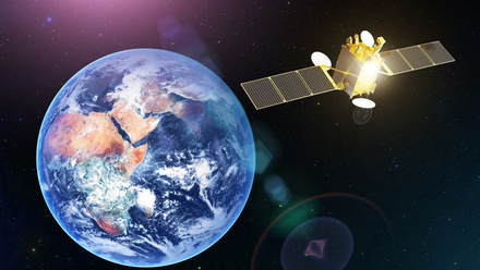
NAVTEX is just a single component of this system. Others include EGC (Enhanced Group Call) as well as satellite service provision by companies such as Inmarsat and Iridium. Evolving technologies include VDES (VHF Data Exchange System) and NAVDAT which is similar to NAVTEX but provides images as well as text.
As previously mentioned, as S-100 ENCs are developed, it is planned to include navigational warnings as a layer within the data depiction on ECDIS machines. The WWNWS meetings provide an opportunity for the various associated experts to consider and discuss these developments with a view to synthesising an argument or position for subsequent submission to the following NCSR meeting.
This whole area of interest is going through an extended period of massive change and exploration, I feel immensely lucky to have a ringside seat with a clear view of how these changes are evolving whilst having an opportunity to contribute, even if only in a very minor way.

